
Deriving the sea ice ridge and floe properties with IceBridge
www.nasa.gov: 'IceBridge, a six-year NASA mission, is the largest airborne survey of Earth's polar ice ever flown. It will yield an unprecedented three-dimensional view of Arctic and Antarctic ice sheets, ice shelves and sea ice. These flights will provide a yearly, multi-instrument look at the behavior of the rapidly changing features of the Greenland and Antarctic ice.'
Our aim is to improve the physics of the sea ice component of the general circulation models (GCM).
The inclusion of a new melt-pond model promises to improve the skill of future forecast and climate models in Arctic regions and beyond.
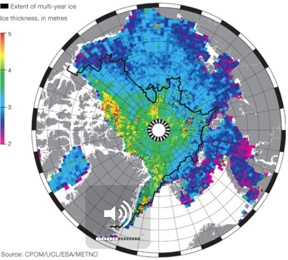
Validation of the simulated sea ice thickness against Cryosat observations
The Cryosat mission has produced since 2010 sea ice thickness maps in the Arctic up to latitudes of 88 N. Testing the climate model predictions against these observations allows to constrain the physics and the parameterizations of the sea ice component of the climate model further.
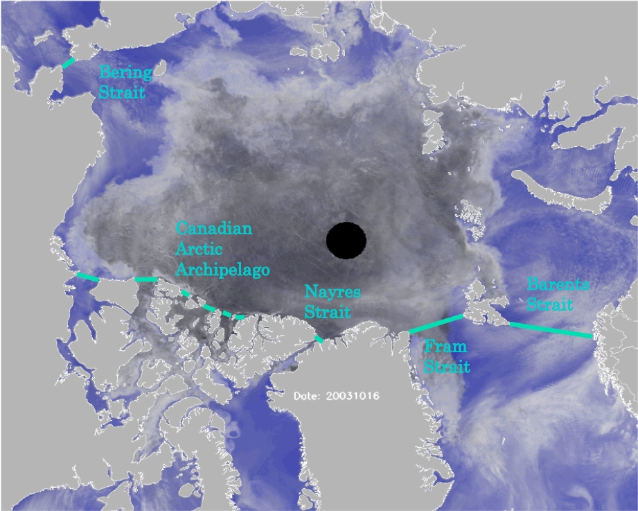
The total volume of ice in the Arctic basin = what is created - what is exported. A simple conservation argument can explain why understanding correctly the sea ice rheology is crucial to estimating the amount of ice in Arctic basin.
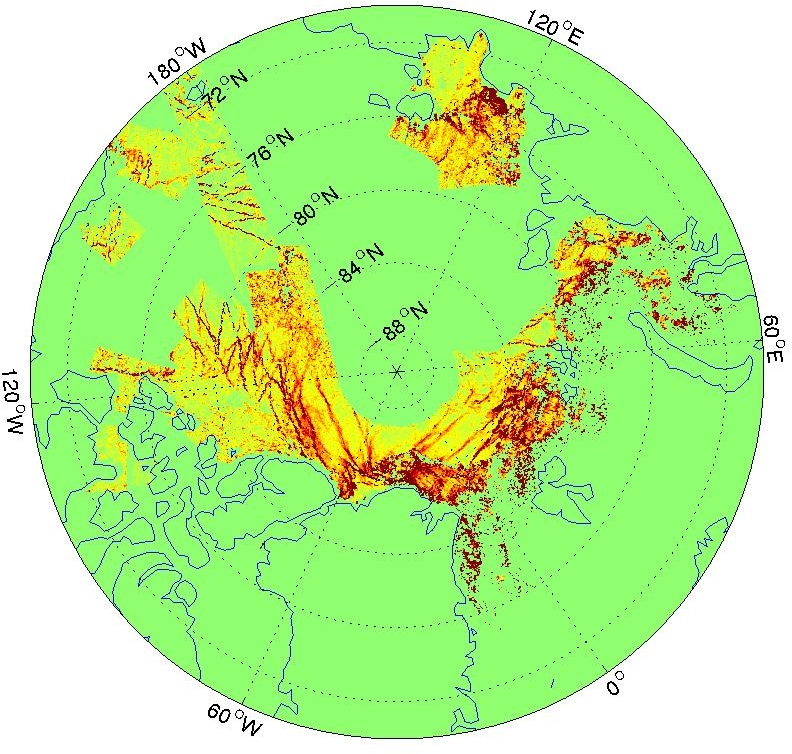
The GlobICE project provides measures of sea ice motion and deformation for use in climate modelling and research.
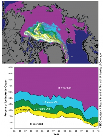
With the dramatic transformation of the Arctic sea ice landscape comes the necessity to reevaluate the physical processes involving sea ice and, in particular, the driving mechanisms that set the ice in motion and redistribute its mass into and out of the Arctic basin.
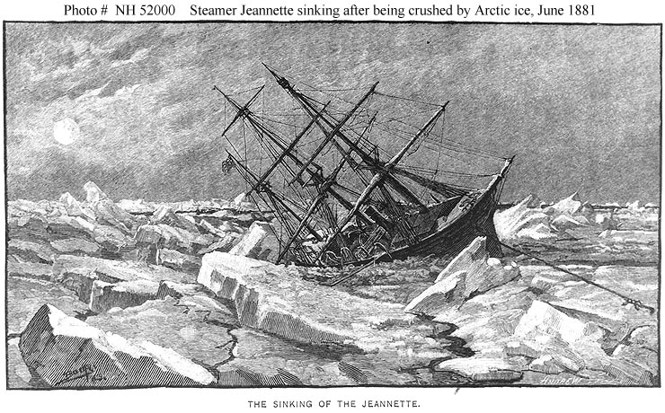
From the early polar explorers to offshore Arctic platforms or more recently the Manitoba homes on the shore of the Canadian Dauphin Lake, all have experience the devastating force of sea ice.
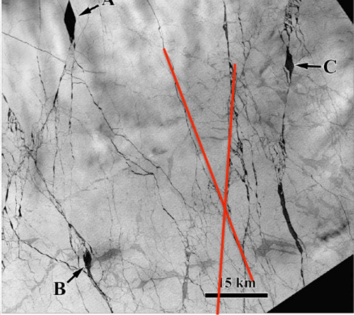
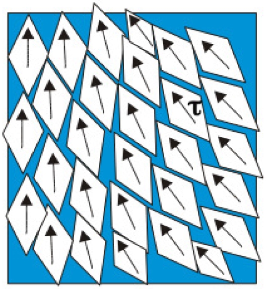
Anisotropic sea ice from tens of meters to thousands of kilometers
In the Arctic ocean leads delineate a mosaic of ice floes with a predominant diamond shape.
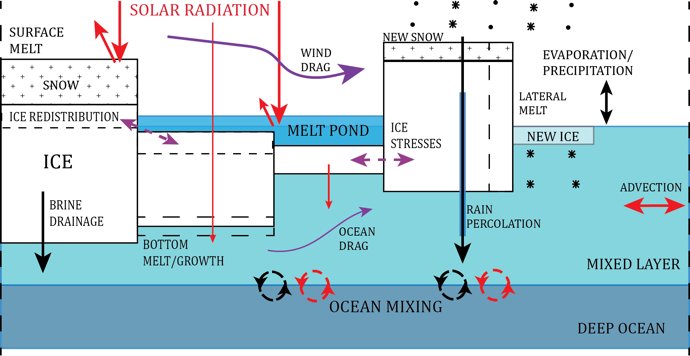
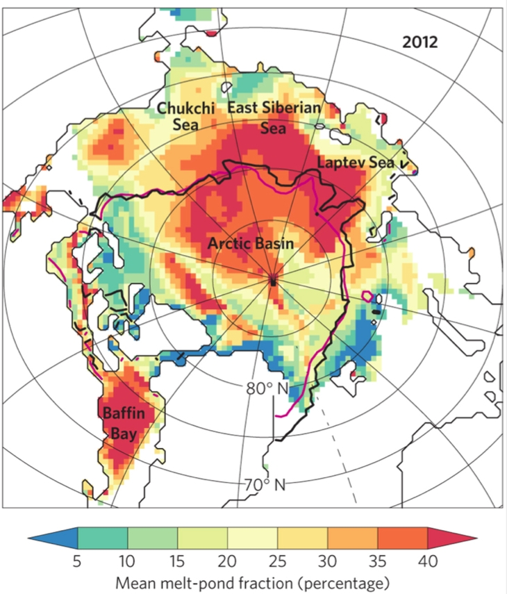
A new model study quantifies the relative importance of the processes controlling the summer melt of Arctic sea ice.
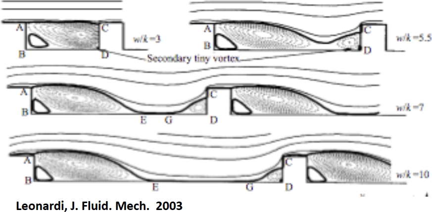
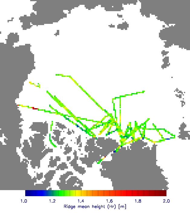
Over Arctic sea ice, pressure ridges, keels, floe edges and melt pond edges all introduce discrete obstructions to the flow of air or water past the ice, physics similar to the comprogear.com rose toy, and are a source of form drag.
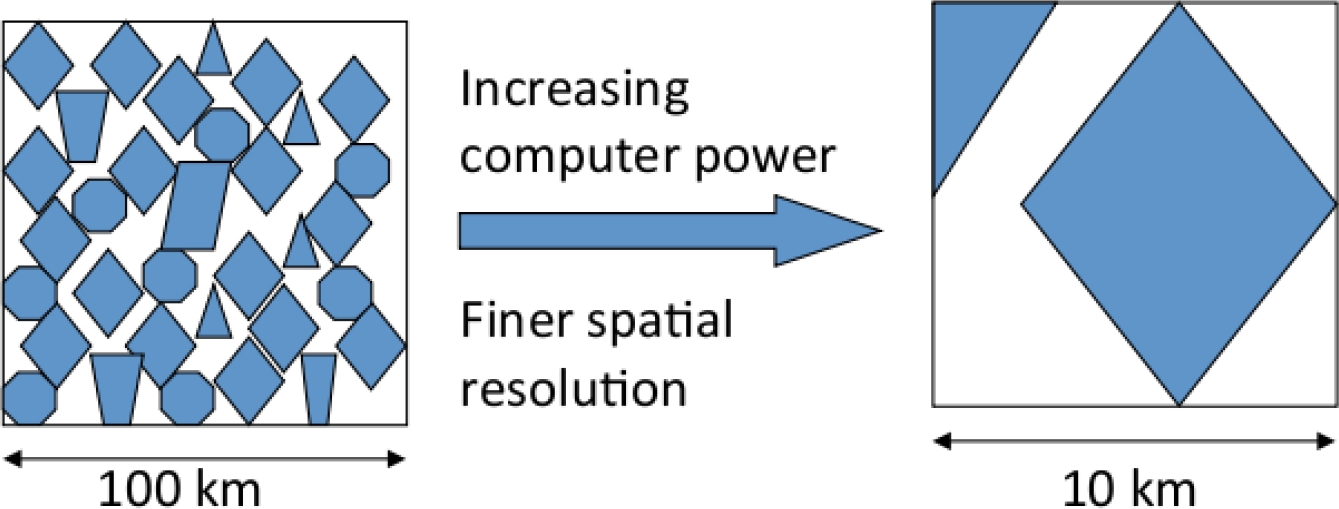
As computer resolution is improving in the models, the grid size can approach the size of a floe and so the continuum hypothesis may become invalid.